Hiking through history on Montana Mountain, Yukon, 1991-1995
This is one of a series of hike reports written from 1991 to 1995 as I was researching the historic mines on Montana Mountain, Yukon, for my first book, "Fractured Veins & Broken Dreams." I carried a notebook, a tape recorder, and a camera on most of the hikes. Photos from each of the hikes have been added.
Dateline: December 31, 2023.
The text of the printed report is in italics.
08:00: Start up north side of canyon. No clouds, but a fair wind blowing. Forecast is for 28 degrees. I told Donna to expect this to be a long day; lots of stress to get rid of with the house purchase and all. Altimeter set at 685 meters.
The tree that I had identified as a grizzly "nest" turns out to be a spot for mountain goats to comb out their winter coat - the tree below 4 feet is just covered with wool and hair.
08:30: Four goats spotted in the "Y" of Pooley and North Pooley canyons; a billy, two nannies and a kid. Got some decent photos of the group as they crossed past the Vault and up the other side.
09:13: 950m; the terminus of Vault tramway No. 1.
Wind has stopped, or at least I'm sheltered from it. Snack break at 1060m to enjoy the space.
1110m: pack trail identified; encountered at the Canyon edge, and it runs to the north quite steeply from there.
Still attempting to find a way into the Vault; it appears that Simon and I were on the right route last time, and must have been extremely close, maybe 300 feet away from it.
1200m., 10:30
1240m: another pack trail, directly below the large stone outcroppings. Traced for about 100m as usual, then switches back at 1250m towards the canyon. Just above that is the first granite.
1275m: back on the pack trail, angling towards the canyon, Photo taken up very clear section, running 30m up a ridge, then angling off away from canyon. At that point the pack trail goes into bear country, so I'm heading directly up the slope.
1315m: can see the Montana mine; the pack trail is clear all through here. Photo of claim posts (4x4s or slightly smaller) at 1315m.
First snow at 1335m. Pack trail lost after that point, never relocated.
11:15, 1460m: large snow field, time for another snack break.
11:52: Photo of post with Montana in background taken at 1410m.
1600m: at 200-300m south of the Montana, a camp with garbage dump, dates 1905-06; hand-soldered tins, boots, brown bottle shards. No hint of a road or pack trail to this spot, or mine workings - seems likely to have been the original Joe Petty camp.
Just south of that is the main part of the camp, with finger-jointed box pieces, lots of enamel kitchenware, a Yukon stove and some ceramic vessels apparently used for preliminary "fire assays" (according to Angus McIntyre).
1635m: wrecked Ford pickup (1967?), just south of the camps.
1625m: claim post photo; in the middle of the Joe Petty road complex.
1675m: Post No. 2 photo, 1/4 of the way from Joe Petty to Thistle.
14:00: at the Thistle/Aurora camp; 1640m. North of the stone house are four stone foundations for canvas-covered frames. The first is 7m x 17-18m; the second is 15m north, 5m x 6m in size; the third is 2m square, the fourth is 5m x 6m. A 1906 claim post is propped up against a rock a few meters away, but may mot be in the original location. Photo taken. Another 1906 post is in its original location a few meters further north, but numbers have been worn away. A 5-meter wide pack trail (photo) just runs about 20 meters before vanishing; may have been the trail to Uranus.
Leave Thistle at 14:50
Photo of straight, flat road across the plateau between Thistle and Montana.
150 meters south of the main Montana workings are 2 sets of tracks which join and lead into a snow-covered adit (I think that the adit has collapsed).
Running out of time; only 1 photo of Mountain Hero taken, an overall view from above.
15:40, heading down from Mtn. Hero. Photo of wide trail just below new road; the photo in the J.B. Tyrrell Papers is possibly of this section.
Fallen tramway stand photo is the third one south of the one that supported the canyon span. At 1515m are the first 2 of many buckets, all in surprisingly good condition. I had thought that maybe I could get one of the buckets out with the truck, but they are way too heavy. They would make great flower boxes! Check the original photos to see which stand design is still standing, and which collapsed.
The stand on the south side of the canyon is at 1490m; it's a very impressive crossing. The cable must have really been whipping when it tore all these stands out; just a short way from the stand (100m), the cables (with buckets, 1 still with ballast rock in it) are about 25m apart.
At 1490m elevation up the canyon being crossed is a good pack trail leading to the summit of the tramway. Seems to be in such good condition because of use as a game trail. When the ground levels out, it disappears.
At the summit are 5 collapsed stands close together, with the timbers widely scattered; the wood seems to attract enough heat from the sun to enhance frost action, and much of the wood is being buried by rocks percolated up!
Photo of stand with bucket on the left is the first one below the 5 on the summit.
Stand at 1355m; the telephone line ran down the tramway route as well.
1345m: good pack trail heads away from creek that turns into canyon just below. The stand above that crossing is at 1310m. Unable to continue following the tramway route from there, because of the combination of topography and time (17:35). The trail is well graded and rock-cribbed, but vanishes under an old rock slide - unable to find it again.
Reached the highway about halfway between Conrad and Pooley Canyon; one hell of a thunderstorm hit about halfway back - got thoroughly soaked. Nearly perfect timing. Back at the car 19:20.
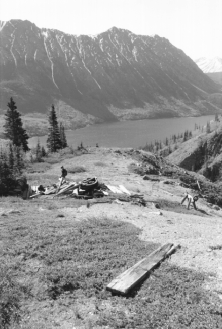
The lower terminus of Vault No. 2 aerial tramway.
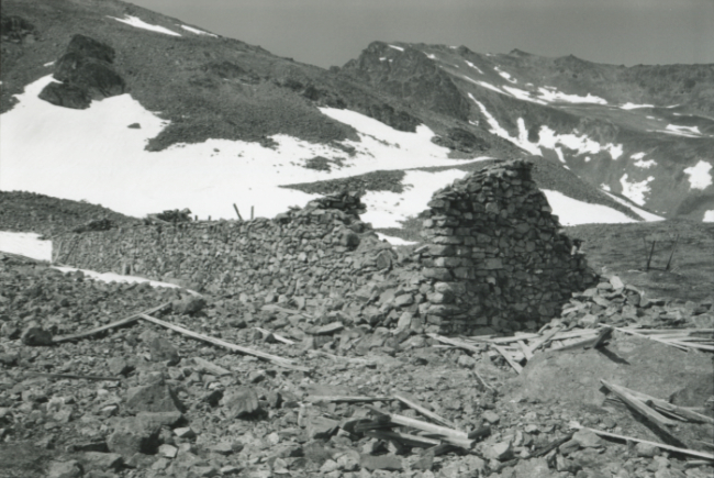
The stone house at the Thistle/Aurora property, at 14:00.
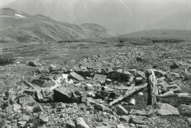
Campsite on the Joe Petty claim, about 300 meters south of the Montana Mine.
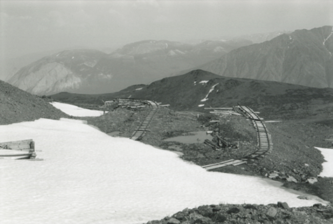
The Montana Mine.
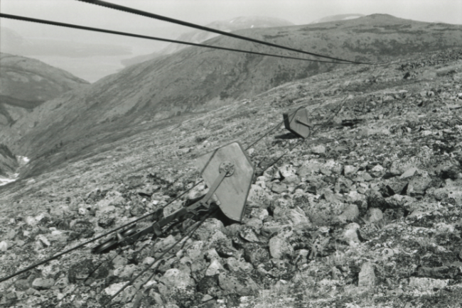
Buckets on a fallen section of the Mountain Hero aerial tramway, at 1515m elevation.
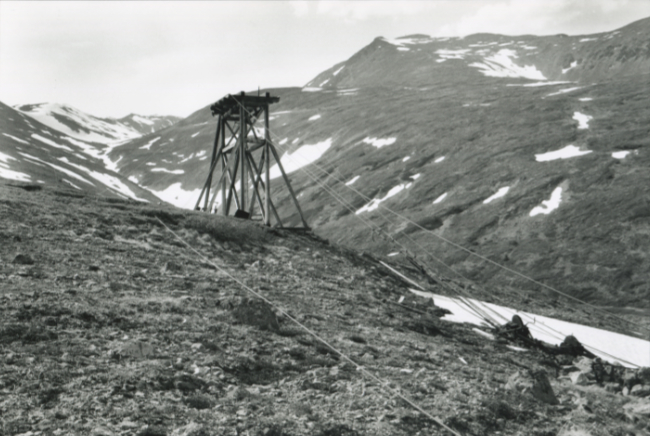
The main support stand for the aerial tramway above the canyon crossing.

Looking down the aerial tramway line to Conrad.







