Mount Edziza Park (BC Parks)
Highway 37, Stewart-Cassiar Highway
Mount Edziza volcanic complex (Wikipedia)
"Edziza: B.C.'s Bizarre Volcanic Park" (by Warren Wilson)
Dateline: January 23, 2024.
Mount Edziza is a mountain that has intrigued me - has been calling me - since I first had a close look at her from my Cessna 172 in 1985. I've created this page to make use of the material I've collected and the photos I've shot over the past 39 years.
More properly called the Mount Edziza volcanic complex (MEVC), an excellent description is provided at Wikipedia, introduced by:
The MEVC... "is a linear group of volcanoes and associated lava flows in northwestern British Columbia. Located on the Tahltan Highland, it is 40 kilometres (25 miles) southeast of Telegraph Creek and 85 kilometres (53 miles) southwest of Dease Lake. The complex encompasses a broad, steep-sided lava plateau that extends over 1,000 square kilometres (390 square miles). Its highest summit is 2,786 metres (9,140 feet) above sea level, making the MEVC the highest of four large complexes in an extensive north-south trending volcanic region. An ice cap obscures the highest summit which is characterized by several outlet glaciers stretching out to lower altitudes.
The MEVC consists of several types of volcanoes, including stratovolcanoes, shield volcanoes, cinder cones and lava domes. These volcanoes have formed over the last 12 million years during five cycles of magmatic activity which spanned Earth's four most recent geologic epochs. Volcanic eruptions during these magmatic cycles issued a wide variety of volcanic rocks that comprise 13 geological formations. The most recent eruptions took place in the last 11,000 years but many of them remain undated.
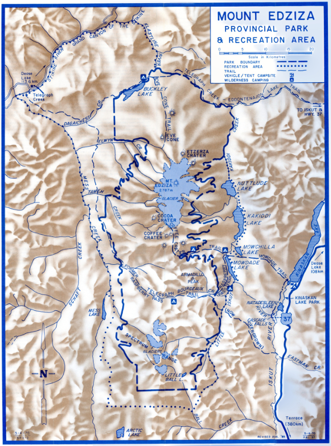
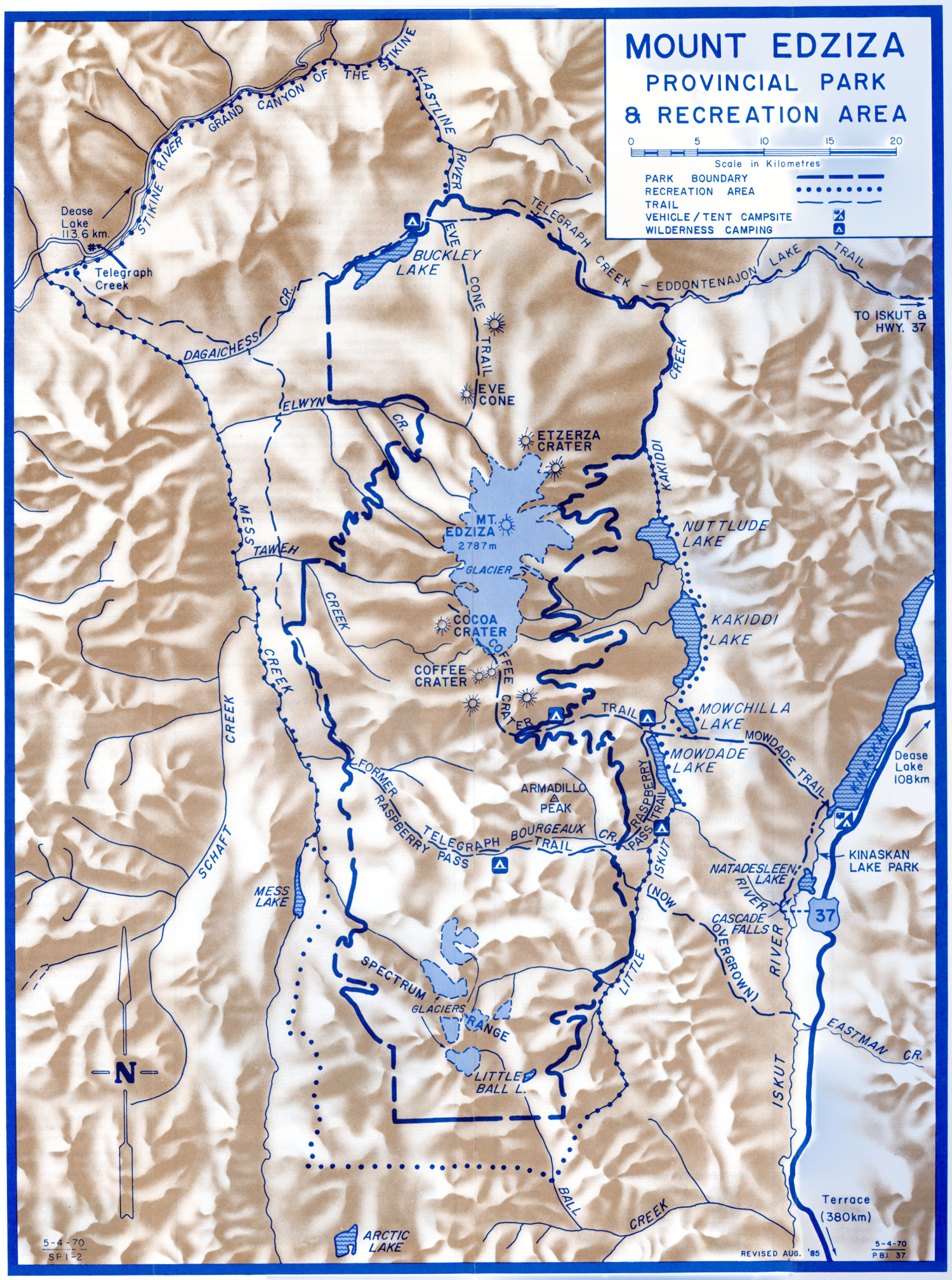
Let's start with a map to get you oriented - click on the image below to open an interactive map in a new window
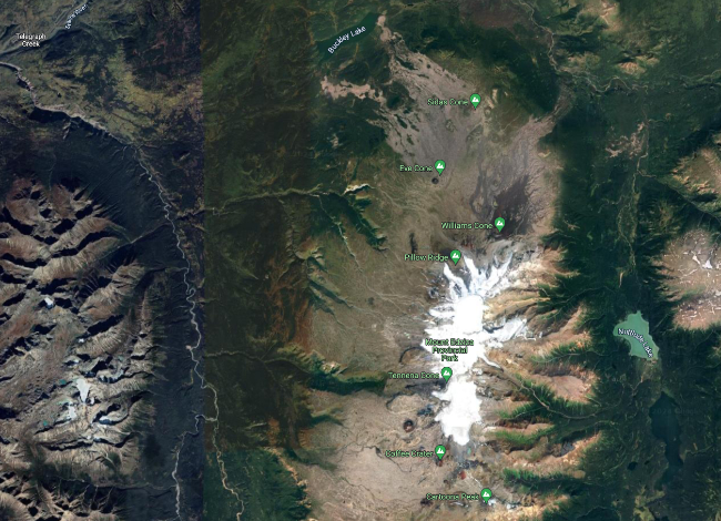
Next, my aerial photos. The first one was shot at very low altitude from my Cessna 172 during my 1985 Flight of Discovery, the next one during another flight in my Cessna on August 28, 1987, and the three that follow have been shot at high altitude during flights between Whitehorse and Vancouver. Click on each to greatly enlarge it.
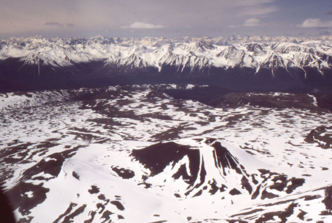
Cocoa Crater, as we flew west from Iskut to Telegraph Creek on June 16, 1985.
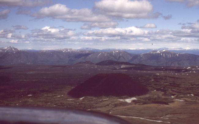
Eve Cone on August 28, 1987, as I was showing my aunt, Nancy Ball of Glenora, what her back yard looks like.
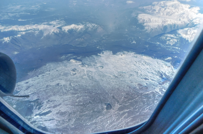
March 31, 2016. Eve Cone is at the lower centre.
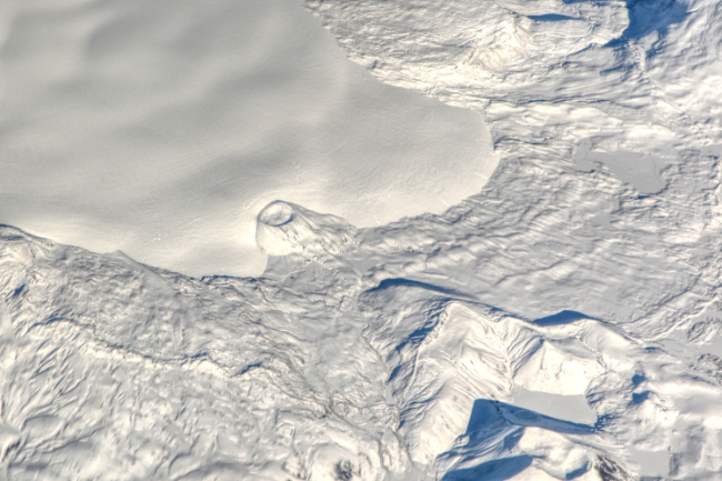
A cider cone on the southern slopes of Mount Edziza, on October 24, 2023, with a 105mm lens.
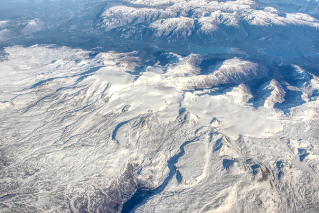
Mount Edziza on October 24, 2023, with a 24mm lens.
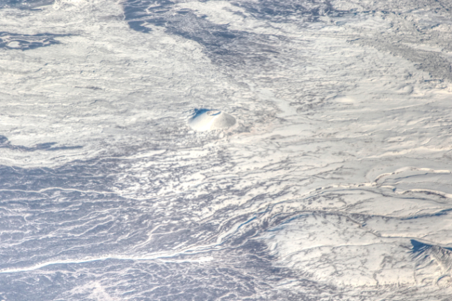
Eve Cone on October 24, 2023, with a 105mm lens.
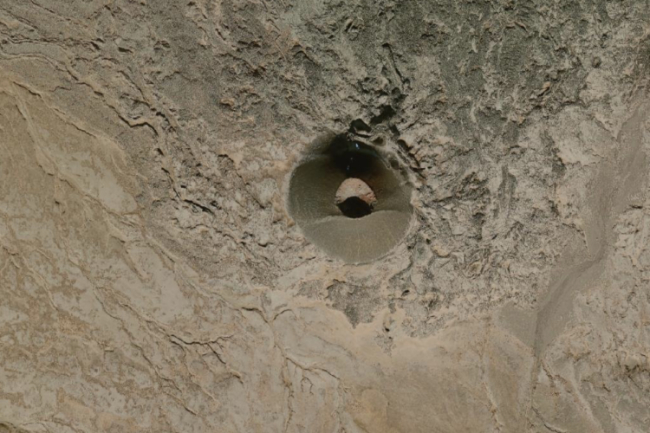
A satellite photo of Eve Cone, from the USGS EarthExplorer.
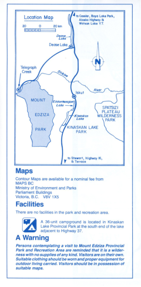
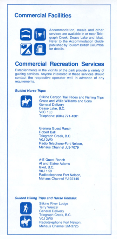
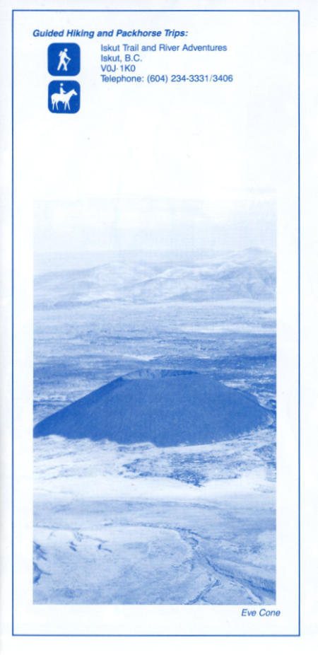
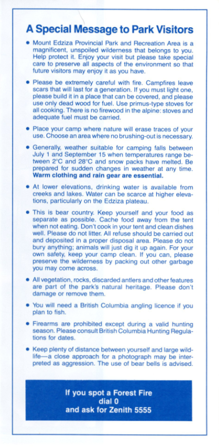
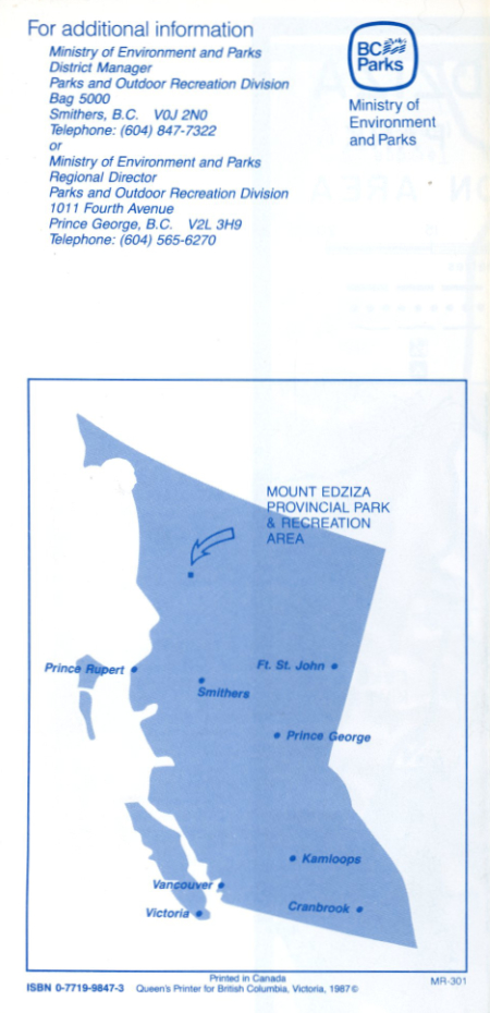
A brochure published by BC Parks in 1987 is reproduced below. Note that the information about access and services may no longer be accurate. See BC Parks for current information.
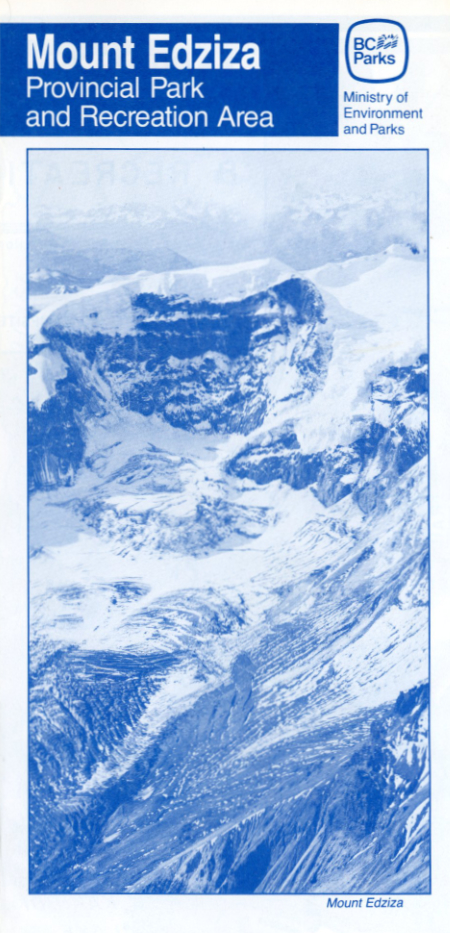
Mount Edziza Provincial Park and Recreation Area encompasses over 230,000 hectares of the Tahitan Highlands in northwestern British Columbia located west of Iskut River and south of the Stikine River. The park and recreation area conserve a spectacular volcanic landscape, including lava flows, basalt plateaus, cinder fields and cones.
Mount Edziza, elevation 2,787 metres, is an outstanding feature of the area. It is a composite volcano consisting of thin basalt flows and a central dome of andesite, dacite and rhyolite with a glaciated crater nearly 2,500 metres in diameter. The eruption that built the mountain and its central cone began four million years ago. Successive lava flows raised the dome above the encircling plateau and spread lava over an area 65 by 25 kilometres. The last basalt flow occurred only ten thousand years ago, solidified in place and plugged the central vent.
In the years since Mount Edziza became dormant, numerous small eruptions have taken place around it, creating some 30 cinder cones. Perfectly symmetrical Eve Cone rises 150 metres above the plateau, as do aptly named Coffee and Cocoa Craters. It is estimated that these cones were formed no more than 1,300 years ago and are basically unaltered by erosion and devoid of vegetation.
To the south, Raspberry Pass separates the Edziza area from the Spectrum Range. Formed from lava flows, these mountains are named for their brilliant red, yellow, white and purple rock. This altered rhyolite resulted from staining by sulphuous mineral waters. Subsequent erosion has resulted in the combination of many tones, giving the landscape the appearance of a vast watercolour.
Along the western boundary, Mess Creek flows north to enter the Stikine River 3 kilometres below the community of Telegraph Creek. Eleven kilometres upstream from this confluence, Mess Creek plunges into a gorge nearly 800 metres deep. To the north of the park boundary, the Stikine River, which means "Great River" in the language of the Tlingit Indians, has carved its tremendous Grand Canyon through eons of volcanic and sedimentary rock deposits.
Prehistorically the area was heavily used by native indians. Obsidian cutting blades and projectile points were manufactured on site and traded throughout northwest America.
On the east bank of Mess Creek and through Raspberry Pass are the remains of the Collins Overland Telegraph which was constructed with the intention of linking North America with Asia and Europe by telegraph. The project was abandoned in 1866 after the successful laying of the transatlantic cable. All that remains are a few poles and collapsed line cabins which once stood every 32 kilometres along the route. The trail is overgrown and no longer passable.
There are five significant lakes within the park and recreation area. Mowdade, Mowchilla, Kakiddi and Nuttlude form a chain along the eastern boundary. Buckley Lake is on the northern border. All drain north into the Klastline River, a tributary of the Stikine. The shapes of Buckley, Nuttlude and Kakiddi have been influenced by lava flows from the slopes above them.
The latter two lakes were possibly formed by the filling of a pre-existing larger lake. There are no fish in Buckley Lake although the eastern lake chain is well-populated with rainbow trout.
Moose are probably the most common large animals in the area. Small herds of Osborn caribou may be seen in alpine and subalpine vegetation zones on the west side of the plateau between Mount Edziza and the western escarpment. Mountain goats and Stone sheep can often be viewed on the south, east and west slopes of Mount Edziza, particularly on the western escarpment, and in the Spectrum Range. Visitors may encounter black and grizzly bears. Grizzlies are occasionally seen above timberline where Arctic ground squirrels are abundant. Wolves are sometimes seen or heard. Buckley Lake supports a large waterfowl and shorebird population which are but a portion of the wide variety of bird species that may be seen in the park.
Summer is short. Snow lingers all year on Mount Edziza. Temperatures may hit the 30°C range in mid-summer but at the same time can drop below freezing at night. Snow and cold, often freezing rain, are possible any day of the year.
How to Get to the Park
There is no vehicle access into Mount Edziza Provincial Park and Recreation Area. Telegraph Creek to the northwest is the nearest community and is connected by secondary road to Dease Lake, 113 kilometres northeast on Highway 37, the Stewart-Cassiar Highway. The park is about 500 kilometres north of Highway 16 at Kitwanga. Dease Lake, via Highways 16 and 37, is approximately 600 kilometres north of Terrace. From Dease Lake to Watson Lake is about 245 kilometres.
Several overland routes can be used to gain access to the park and recreation area. The Mowdade trail leads from Kinaskan Lake Provincial Park on Highway 37 to the Coffee Crater - Cocoa Crater area of the park via Mowdade Lake. A boat is necessary to reach the trail head on the west bank of the Iskut River near the outlet of Kinaskan Lake.
The Telegraph Creek-Eddontenajon Lake trail starts at the A-E Guest Ranch at Iskut and follows the Klastine River to Buckley Lake.
For information and assistance in selecting a suitable route contact the Parks and Outdoor Recreation Division in Smithers or Prince George well in advance of any proposed visit.
Trans Provincial Airlines has scheduled flights from Terrace to Dease Lake in the summer. Float planes may be chartered to fly into Buckley, Mowdade, Arctic or other lakes. B.C.-Yukon Air Service and Flywest Charters may be chartered at Dease Lake
and Trans Provincial Airlines at Eddontenajon Lake. Telair Services fly out of Telegraph Creek and helicopter charters are available at Dease Lake.
It must be emphasized that trails are not marked and all are difficult to traverse and often overgrown. The park is not directly supervised; few hikers frequent the area, and those that do have skill and stamina. This is no place for the ill-equipped or the inexperienced.
Click on the map to greatly enlarge it in a new window.