Glaciers & Icefields
Dateline: September 23, 2026. Last update: September 27, 2026
This page offers a brief summary with maps from "Late Wisconsinan McConnell glaciation of the Whitehorse map area (105D), Yukon" by Jeffrey D. Bond, Yukon Geological Survey.
The area around what is now Whitehorse has been buried by ice several times. The last glaciation, known as the McConnell, began about 29,000 years ago, though significant ice may only go back 26,000 years. Dates on the periods seen in the maps below are not known, but at its peak, the McConnell glaciation saw ice over 1,350 meters deep at Whitehorse. By 10,700 years ago, the ice had been gone for long enough that vegetation had been re-established.
The maps below show various periods during deglaciation, when huge lakes were formed by the melting ice. The first two maps in Bond's paper show the start of the ice advance, and the area completely covered by ice.
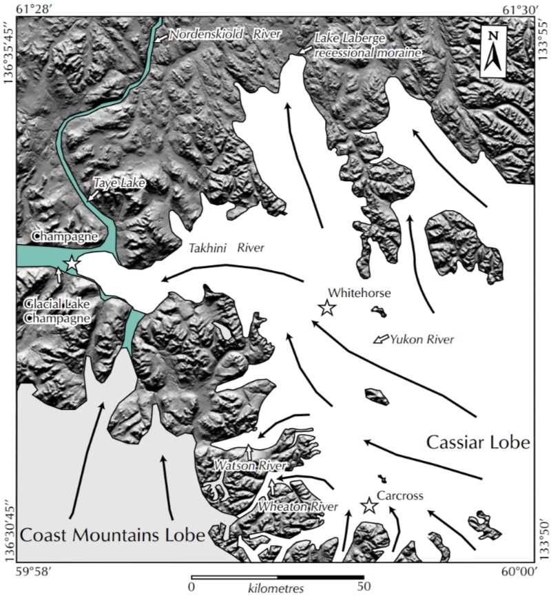
Cassiar re-advance. A schematic diagram showing the approximate limit of the Cassiar re-advance during deglaciation. Up-valley ice flow in the Takhini River valley dammed the westward drainage and created Glacial Lake Champagne.
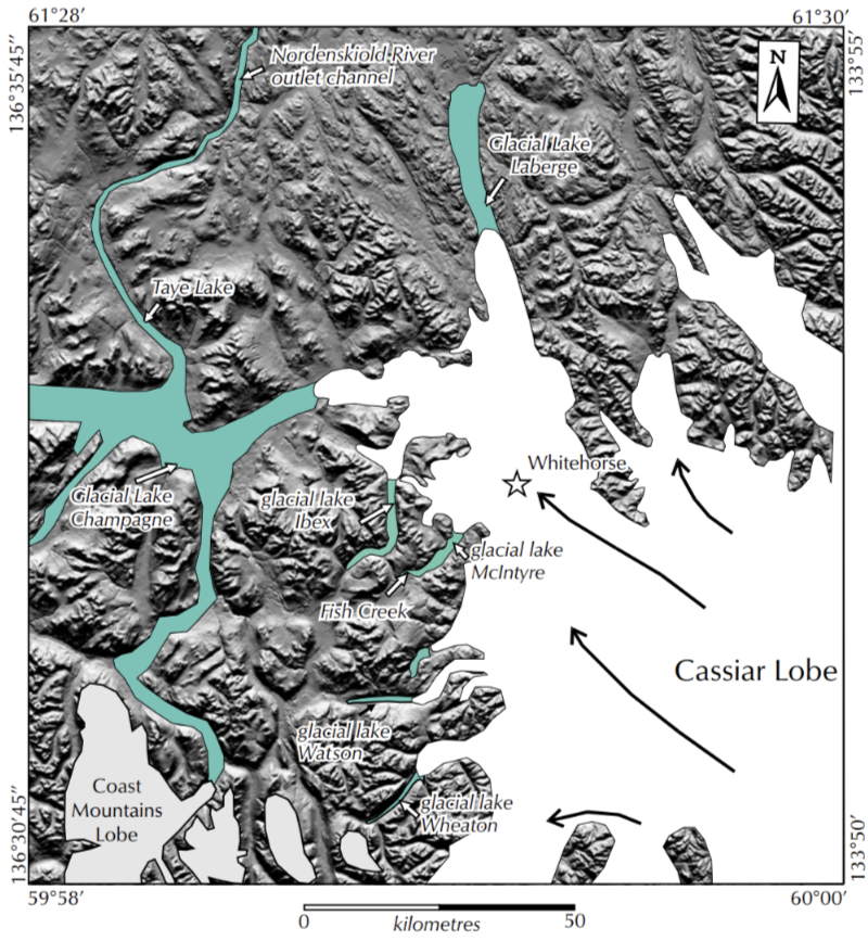
Ibex stage. This stage is defined by a recessional glacial limit that blocked the mouths of the Ibex River valley and Fish Lake. Ice tongues in the Yukon and Takhini river valleys retreated from the Cassiar re-advance limit, enlarging the glacial lakes in these valleys.
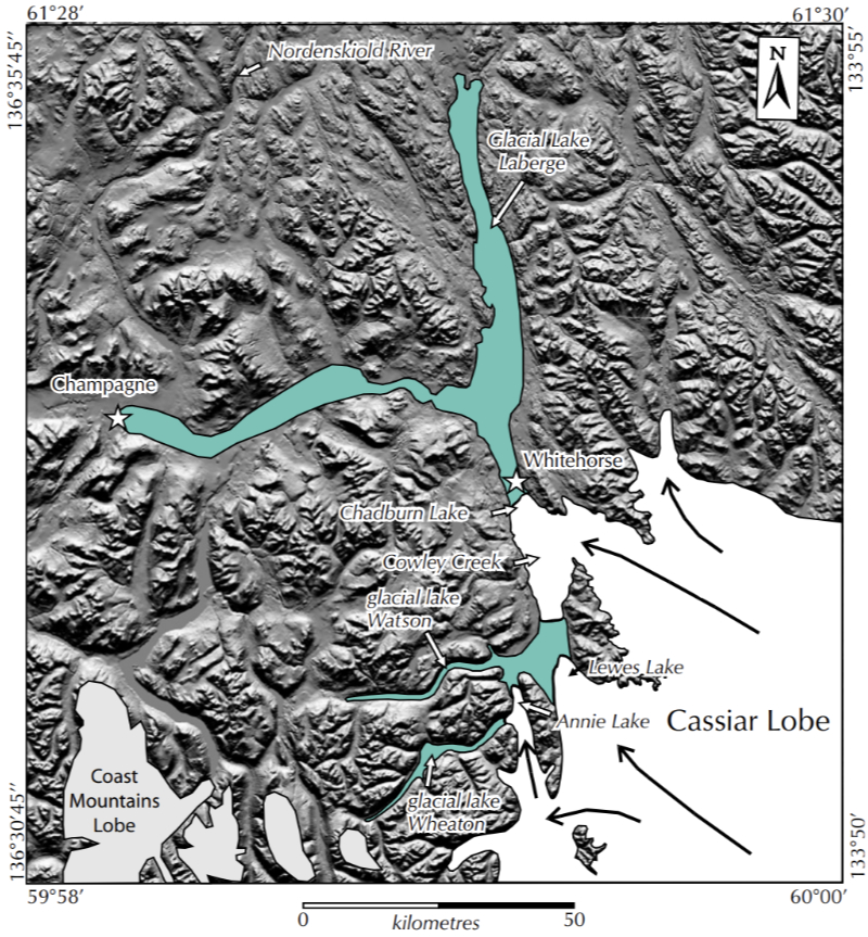
Chadburn stage. The Chadburn stage is a well defined recessional limit in the Whitehorse area.
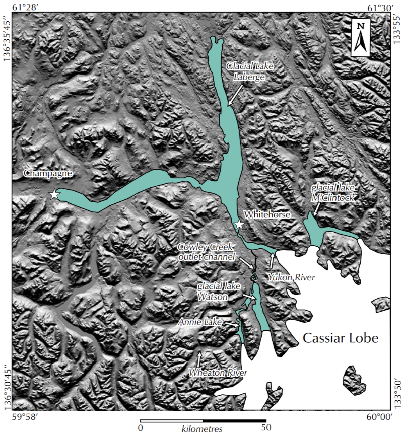
Cowley stage. This stage is defined by the activation of the Cowley Creek outlet
channel for glacial lake Watson.
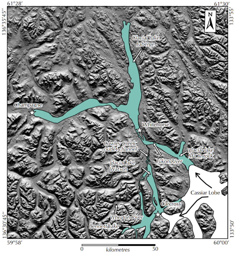
Bennett stage. This recessional stage is defined by an ice limit near
the village of Carcross at the east end of Bennett Lake. Glacial lake ponding in
Bennett Lake would have been part of glacial lake Watson.

M'Clintock stage. The last stage of McConnell ice in the Whitehorse map area.
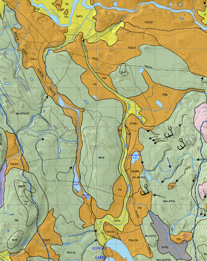
The Cowley Creek outlet channel for glacial lake Watson (the yellow area on the map below) as well as many other features can be seen very clearly on Geoscience Map 2005-6: Surficial Geology of MacRae.