
|






|
|
Alaska Highway Postcards: Real Photo AZO, 1943-44
An Explorer's Guide to the Alaska Highway
This set of 42 postcards was the most successful of early postcard series, at least partly because of the high quality. The stamp box on the reverse of all of the postcards in this large set show that they are real photos, printed on Eastman Kodak silver chloride paper known as AZO paper - this stamp box design was used until 1949.
Click on each image to greatly enlarge it and see both sides of the postcard.

|
#1 - View along the new Alaska Highway through Canada's wilderness.
Built by a welcome army of U. S. soldiers.
Permission Wartime Information Board.
This photograph shows the infamous "Suicide Hill" near Mile 148.
|

|
#2 - View along the new Alaska Highway through Canada's wilderness.
Built by a welcome army of U. S. soldiers.
Permission Wartime Information Board.
|
|
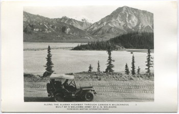
#3 - Along the Alaska Highway through Canada's wilderness.
Built by a welcome army of U. S. soldiers.
Permission Wartime Information Board.
|
|
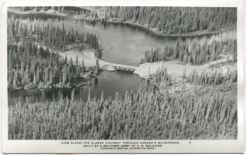
#4 - View along the Alaska Highway through Canada's wilderness.
Built by a welcome army of U. S. soldiers.
Permission Wartime Information Board.
|
|
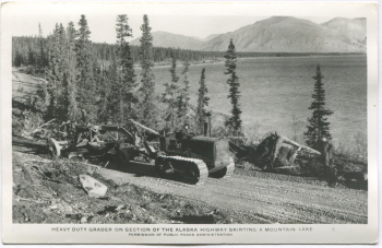
#5 - Heavy duty grader on section of the Alaska Highway skirting a mountain lake.
Permission of Public Roads Administration.
|
|
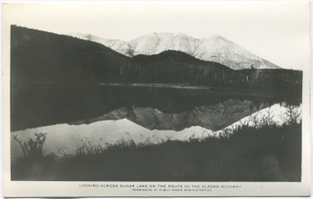
#7 - Looking across Sugar Lake on the route of the Alaska Highway.
Permission of Public Roads Administration.
|
|
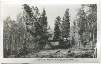
#8 - Clearing the way for the new Alaska Highway.
Canadian timber was a pushover for powerful tractors.
Permission of Public Roads Administration.
|
|
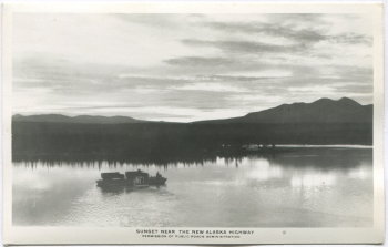
#9 - Sunset near the new Alaska Highway.
Permission of Public Roads Administration.
|
|
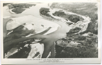
#10 - Looking upstream at the Peace River which is crossed by the Alaska Highway.
Permission of Public Roads Administration.
|
|
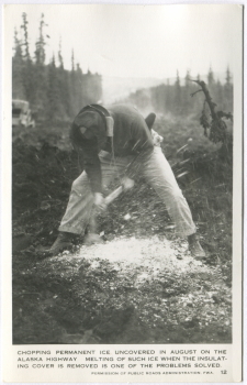
#12 - Chopping permanent ice uncovered in August on the Alaska Highway. Melting of such ice when the insulating cover is removed is one of the problems solved.
Permission of Public Roads Administration. FWA.
|
|
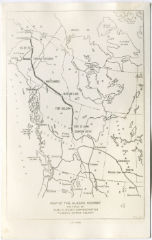
#13 - Map of the Alaska Highway. Prepared by Public Roads Administration, Federal Works Agency.
The differences between the road system in 1943 and today in the north are quite dramatic. Among the many changes: Highway 16 now runs from Prince Rupert to the Alberta border through Prince George; the Stewart-Cassiar now connects Highway 16 to the Alaska Highway; the Hart Highway now runs from Prince George to Dawson Creek; Highway 40 now connects Jasper to the north; the South Klondike Highway has replaced the railway between Whitehorse and Skagway; and the George Parks Highway parallels the Alaska Railroad between Fairbanks and Anchorage.
|
|
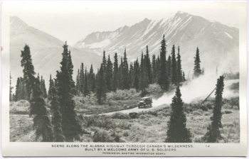
#14 - Scene along the Alaska Highway through Canada's wilderness.
Built by a welcome army of U. S. soldiers.
Permission Wartime Information Board.
|

|
#15 - Along the Alaska Highway through Canada's wilderness.
Built by a welcome army of U. S. soldiers.
Pontoon bridge allowed traffic while semi-permanent one is completed.
Permission Wartime Information Board.
|
|
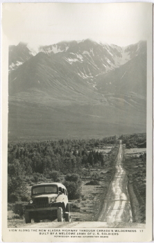
#17 - View along the Alaska Highway through Canada's wilderness.
Built by a welcome army of U. S. soldiers.
Permission Wartime Information Board.
|
|
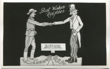
#18 - Best Wishes, Neighbor.
The Alaska Highway.
Built by a welcome army of U. S. soldiers.
Copyright Canadian Post Card Co., Toronto.
|

|
#32 - Army carry-all making good time on the packed snow on the Alaska Highway near Morley Bay, Dawson Peaks in distance.
Public Roads Administration, FWA.
|
|
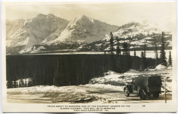
#34 - Truck about to descend one of the steepest grades on the Alaska Highway, this will be eliminated.
Public Roads Administration, FWA.
|
|
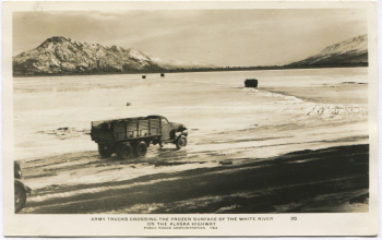
#35 - Army trucks crossing the frozen surface of the White River on the Alaska Highway.
Public Roads Administration, FWA.
|
|
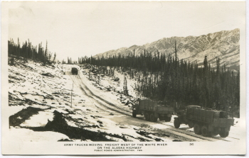
#36 - Army trucks moving freight west of the White River on the Alaska Highway.
Public Roads Administration, FWA.
|
|
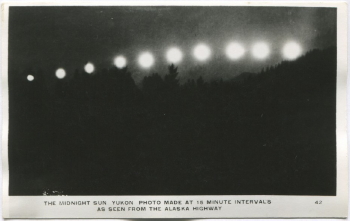
#42 - The midnight sun, Yukon. Photo made at 15 minute intervals.
As seen from the Alaska Highway.
|
|

|
