Hiking through history on Montana Mountain, Yukon, 1991-1995
This is one of a series of hike reports written from 1991 to 1995 as I was researching the historic mines on Montana Mountain, Yukon, for my first book, "Fractured Veins & Broken Dreams." I carried a notebook, a tape recorder, and a camera on most of the hikes. Photos from each of the hikes have been added.
Dateline: December 31, 2023.
The text of the printed report is in italics.
This attempt to find the route into the Vault mine is based on a Muirhead photo that I get from the University of Toronto a few weeks ago; it clearly shows a pack trail leading from the triple tramway stand to the mine camp. Simon and I were not able to find a trail from that point, but obviously didn't search hard enough (and had no reason to believe that the trail actually ran from that point).
Park the truck at the foot of Pooley Canyon; set altimeter to 675m; head up the mountain at 10:50. This is the first time I've been up the south side in a very long time. There are a few clouds down towards Skagway, but it's gorgeous here; probably 23-25 degrees. No clouds, no wind. I brought lots of clothes, but most of them were left in the truck (mainly because my little day pack wasn't big enough to carry them all).
There is a new camp at the Venus now, set up for the tailings pond containment project that Environment is doing. There are 3 new man-camp trailers now, an the level below the workshop, and a generator is running.
Lots of berries today; low- and high-bush cranberries, juniper berries, kinnikinick. Dusty blue carpet of juniper berries in places.
875m: the first trees, poplar and willow; the route goes to the left around these trees, away from the canyon, then back toward the canyon across a stable rockslide and meadow.
Much too warm, had to strip down in sight of the camp, so left my shorts on - "damn civilization!"
On reaching the cliffs, there is a slot heading up about 30m from the canyon. Above this are the first evergreen trees, at 910m.
11:06. This trip feels very good. I'd love to see my grizzly today (although I'm fussy - I just want to see him on the far
side of the canyon).
925m: stump of lightning-blasted tree, 19 inches in diameter (measured with my arm).
Skirt around a canyon that tops cut at 940m; then another one that tops at 990m. Near the stand are stumps of trees about 15 inches diameter that were cut for the uprights; all the other stands used milled timbers. The stands are 12-13 feet high. Lunch break.
11:45: "I'm fucked if I can see where a trail runs from here!" It's very cool in the shadows, so get dressed again, and head down a very steep, heavily-wooded slope from the stand. Only the fact that the photo clearly shows the trail keeps me going. About 100m
down from the stand, I run into the trail. Although I sometimes wonder if what I've found is really a trail, or just a game track, or natural formation, there is no question about this one. It has cribbing in some places, and was well built, though narrow. This discovery is very exciting, after 3 years looking for it.
Some of the corners have talus runs that are quite dangerous - nothing to grab onto for hundreds of feet. No place to get cocky!
Just before the second tramway stand, the trail is obliterated by several large talus slides. I found it again just near the top of the furthest slide. Just before the tram stand (20m) there was a wooden bridge about 10 feet long that has of course collapsed.
There is no other way across the slot that it crossed, so I have to go way up and around. Keep coming to dead-ends at cliffs, but finally found a half-chimney that I just fit into with my pack. The rocks at one of the dead-ends were well-worn, apparently from goats, but I couldn't get a toe-hold on it. The chimney leads me up to 1060m, and the mine camp pops into view tantalizingly close.
There is a wide, very steep slope to cross, half talus and half bare granite. Not extremely unnerving, because there are places where you could grab onto stuff on the way down. There is frost in the ground now - it's colder than I thought it was.
Ran into the telephone wire, and the slope it runs down looks climbable; it may be the one that people say they come down.
Stumbled directly onto the main adit; what a spot! The adit follows a wide quartz vein about 10 inches across, running directly into the mountain. The rock is very rotten, and they must have had extensive timbering. The adit is open as far as I can see (70-80 feet). Too bad the ceiling is so loose; this one really intrigues me - I guess because I worked so damn hard to find it.
The railway ran across the roof of this shop, and was dumped into a granite chute, presumably to be sorted at the bottom - what a wild operation! Some heavy belting in the shop, but nothing else.
The trail from here was obviously a major one, but has been pretty well wiped out. This place is really quite unnerving to be at alone; [t's been a long time since I've been in such a dangerous spot.
There was a small cable system to run supplies from the cookhouse/blacksmith shop to the adit. The tramway terminus is below, but I can't get to it; maybe if I was fresh, or had someone else here, but the cliff is too damn steep, with no safetys.
13:20: This is definitely the most complete camp I've found yet. The building that is still completely standing has a stove (or rather a hearth), bed, table that would seat 4, and a bench. There is a gas lamp, a keg of nails clearly addressed to the "C.Y.M. Co., Conrad" (Canadian Yukon Mining Company), pots, and a finger-jointed compartmented box.
Joining the blacksmith shop is the main building, though totally collapsed, apparently destroyed by snow-and-rockslides. It was about 70 feet by 15 feet, with a walkway joining it to the shop. I've sheet the roll of black-and-white that I brought to finish off my artifact inventory, now I'm switching to slides to partially duplicate them on the way out.
Sitting at the shop having lunch (and my celebratery beer - which tastes extremely good), it all seems strange - whatever I hoped to find here, isn't here. Although I had to get here, I don't know why. And now I'm very unnerved; I got here, now how in hell do I get out? I miss Simon - we used to have a great time up here, and I think that if he was here I'd be enjoying it much more.
There's a bit of garbage around, and I put it all in my pack to take out - it really spoils the feeling that nobody has been here since 1906. Of original garbage, there is lots of fuse and band iron, in particular. I picked up a wonderful little hook that may
have been used on the cable. I know that I shouldn't take stuff, but I also know that if I don't someone else will.
14:00: heading out, up the slot that the telephone line came down. There were pieces of trail all the way up, and it was a fairly easy climb. It comes out just above the gully where I took a photo of Simon overlooking Windy Arm; I remember looking at this direction, and I believe even starting over here, but deciding that there was no way the trail was here - Wrong!
15:55: back at the truck.
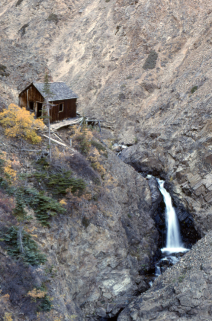
The blacksmith shop at the Vault mine. The collapsed ruins of the cookhouse/bunkhouse are hidden behind it.
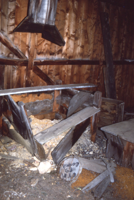
Inside the blacksmith shop. A keg of nails broken open is addressed to CYM (Conrad Yukon Mines), Conrad.
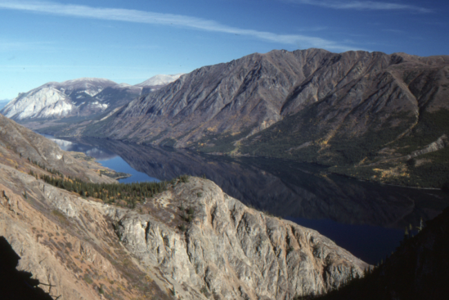
Looking across to the north side of the canyon, and Windy Arm.
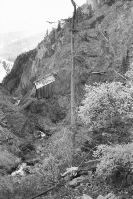
The aerial tramway terminus at the Vault Mine.
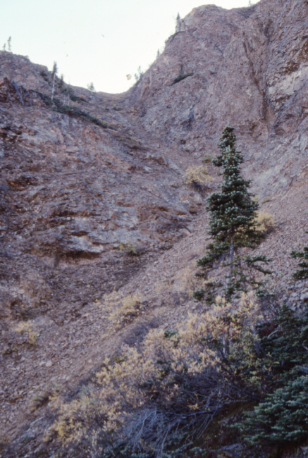
Heading out, up the slot that the telephone line came down







